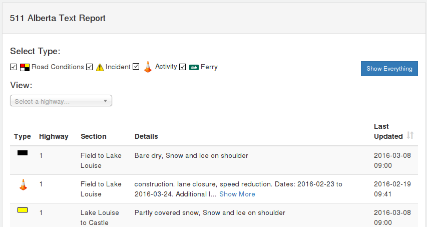
511 Alberta is an interactive, easy to use system allowing travellers to quickly access timely and reliable information on road conditions, traffic, roadwork activities and incidents on the provincial highways. 511 Alberta offers multiple ways to access information:

Road condition details, Cameras, and Events are automatically selected. Definitions and an explanation of our home page legend outlining the displayed conditions on our map can be found on our site at the following link Legend definitions page >>>
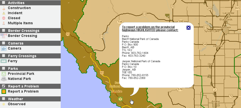
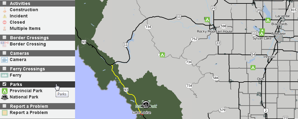
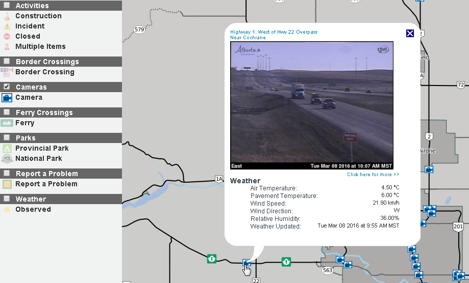
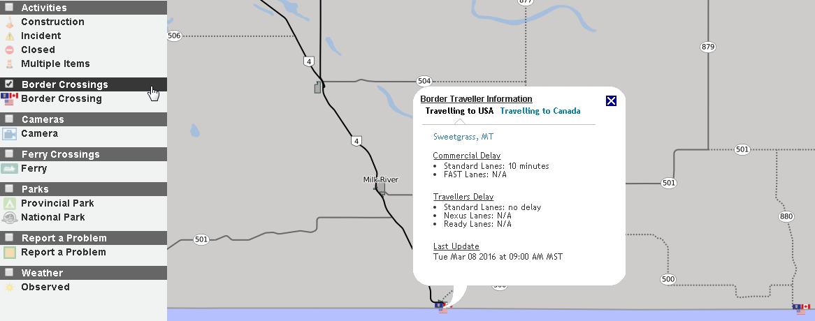
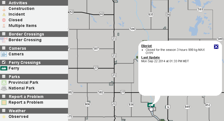
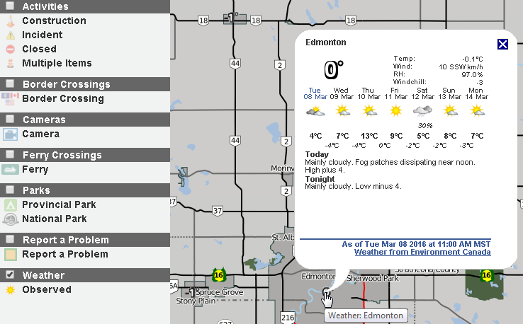
The following information can be accessed by selecting/checking the appropriate box on the map legend menu:
The map automatically displays Cameras and Incident icons. Not interested in a certain type(s) of information? Then uncheck the appropriate box on the map Legend drop-down menu.
 It’s worth noting that in the summer, where multiple segments
of the same highway are reporting the same road conditions our intelligent
system will report the conditions from the location of the start of the road
segments which are identical to the end location of those road segments. For
example if the conditions of all the individual segments of Highway 1 from the
Saskatchewan Border to Calgary are identical then the text report will report
that stretch of highway as one large segment.
It’s worth noting that in the summer, where multiple segments
of the same highway are reporting the same road conditions our intelligent
system will report the conditions from the location of the start of the road
segments which are identical to the end location of those road segments. For
example if the conditions of all the individual segments of Highway 1 from the
Saskatchewan Border to Calgary are identical then the text report will report
that stretch of highway as one large segment.
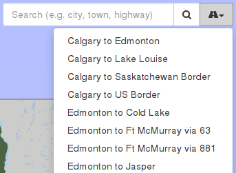
This feature allows travellers to quickly access road condition and incident
information on pre-defined routes along the Alberta provincial highway network.